About The Four Natural Regions Of Texas
What are the four Texas regions and how are they different? A natural region is a geographical area set apart from its neighbors on the basis of its distinctive landforms, water bodies, climate and vegetation. Texas – with hundreds miles of coastline on the Gulf of Mexico as well as mountains reaching to nearly 9,000 feet above sea level in its western interior – has a varied geographical profile, which can be divided into four natural regions: the Gulf Coastal Plains, the Great Plains, the North-Central Plains and the Basin and Range.
The Gulf Coastal Plains
Consuming most of the eastern and southern portions of Texas and a third of the state overall, the Gulf Coastal Plains region is characterized by rolling terrain, pine and hardwood forests and a hot, humid climate for most of the year. Receiving about 30 to 55 inches of rain a year, the region is susceptible to hurricane damage in its coastal areas.
It includes three major rivers – the Brazos, the Colorado and the Trinity – that have fertile soils along their banks. Houston, the largest city in Texas and the fourth-largest in the United States as of 2014, sits on the Gulf of Mexico in this region.
The Gulf Coastal Plains region includes six subregions: the Pine Belt, the Post Oak Belt, the Blackland Belt, the Coastal Prairies, the Lower Rio Grande Valley and the Rio Grande Plain. These subregions are characterized by distinct soils, plants and economic industries.
The North-Central Plains
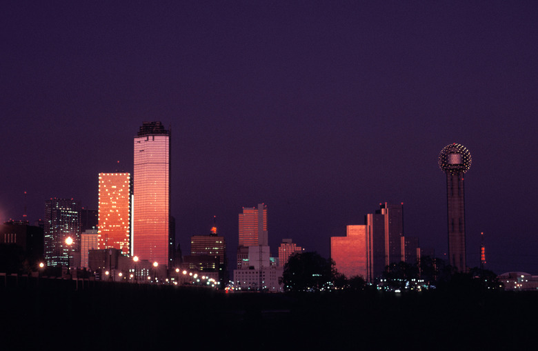
The North-Central Plains region is bordered on the north and the south by the Red and Colorado rivers respectively, on the west by the Caprock Escarpment, and on the east by the Gulf Coastal Plain. In fact, Dallas, Texas' second-largest city with a population of over 1.3 million as of 2014, rests on the border between the Gulf Coastal and North-Central plains, although most of the Dallas-Fort Worth Metroplex lies inside the North-Central Plains.
This region features thick grasses and rolling grasslands as well as plenty of limestone. It has much lower humidity than most of the state, gets 20 to 30 inches of rain a year and is a frequent target of tornadoes. There are three subregions within the North-Central Plains: West Texas Rolling Plains, Grand Prairie and Eastern and Western Cross Timbers.
The Great Plains
Extending into the base of the Rocky Mountains, the Great Plains region extends from the North-Central Plain on the east northward to consume most of the Texas Panhandle and westward to the Basin and Range region. A different part of Texas, it is notably flat and free of vegetation; dust storms are common, and the region gets only about 16 to 20 inches of rain per year.
With hot summers yet cold winters, it is less hospitable than other parts of Texas and accordingly has fewer large cities and a much lower population density. Amarillo and Lubbock, the latter home to Texas Tech University, were its largest cities as of 2014. The four subregions in the Great Plains are the High Plains, Edwards Plateau, Toyah Basin and Llano Basin.
The Basin and Range
Also known as the Mountains and Basins region, this is the smallest of the four Texas regions and includes the westernmost projection of Texas that lies south of New Mexico and north of the Rio Grande River. As the name suggests, it houses a number of drainage basins as well as Texas' highest mountains – the Guadalupe Mountains.
The Basin and Range is home to the Pecos River and Big Bend National Park, and gets only about eight inches of rain a year in the low-lying areas, with the mountains experiencing closer to 20 inches. There are four subregions in the Basin and Range: Guadalupe Mountains, Davis Mountains, Big Bend and the Upper Rio Grande Valley.
Cite This Article
MLA
Crystal, Mike. "About The Four Natural Regions Of Texas" sciencing.com, https://www.sciencing.com/four-natural-regions-texas-4567476/. 20 October 2021.
APA
Crystal, Mike. (2021, October 20). About The Four Natural Regions Of Texas. sciencing.com. Retrieved from https://www.sciencing.com/four-natural-regions-texas-4567476/
Chicago
Crystal, Mike. About The Four Natural Regions Of Texas last modified March 24, 2022. https://www.sciencing.com/four-natural-regions-texas-4567476/