
Maine is the largest New England state in the far northeastern tip of the United States. New Hampshire, the Atlantic Ocean and the Canadian Provinces of Quebec and New Brunswick border Maine. The state has a variety of topographical features, including coastal and inland landforms. The beauty of the natural landforms attracts artists to live and work in Maine.
Coastal Landforms
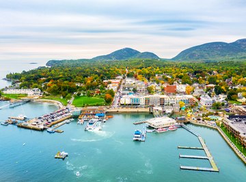
Maine's distinctive coastal landforms include its glacially carved jagged rocky bays and inlets. The rockbound coastline is interspersed with stretches of sandy beaches at its southern edge. Many islands composed of weathered igneous and metamorphic rock lay just off the coast. Half of Maine's tidal coastline features cliffs eroded out of the glacial drift deposited by the ice sheets of the last period of glaciation. The rest of the coast has granite rock formations gently sloping down to the shore.
Mountains
The landforms of the Appalachian Mountains dominate the northwestern section of Maine. The mountains are ancient landforms showing the affects of millions of years of erosion. The state's major mountain range is Longfellow Mountains, scattered along the border with Canada in northeastern Maine. The range is an extension of New Hampshire's White Mountains. The highest landform in the state is 5,267 ft. Mount Katahdin in Baxter State Park at the north end of the Appalachian Trail.
Waterways
Waterways are significant landforms of Maine. St. John is the state's longest river. Maine's other major water channels include the Saco, Penobscot, Kennebec and Androscoggin rivers. There are 5,000 streams and rivers across the state. North-central Maine is dotted with many deep water lakes, left by the glaciers 12,500 years ago. Coastal salt-marsh and estuaries are aqueous landforms supporting many species of wildlife. Many low gravel-ridged landforms known as eskers are spread across Maine, deposited by ancient rivers flowing under the glacial ice sheets.
Lowlands
The lowland areas of Maine are concentrated in the southeast section of the state. The lowlands are densely forested with pine trees. Lowland geographical landforms include fertile farmlands where Maine's potato crop is grown. Much of the lowlands were pushed down to their elevations by the weight of the mile thick glacial ice. Glacial till, or ground-up rock, provides the lowlands areas with their thick covering of layers of rich soil.