Researchers and forecasters have been making weather maps since the mid-19th century to analyze weather patterns and storm systems. Using symbols to represent different meteorological phenomena, weather maps quickly convey a large amount of information all at once. With weather data to refer to, and using the conventional symbols, you can make your own weather map.
- Standard map
- Weather map or weather data
- Paper
- Pen or pencil
- Colored pencils or markers

Print out an outline map of the area of interest to you. Outline maps can be found online for just about any country or region in the world. Alternatively, trace a map of the desired region. It may be helpful to draw some landmarks onto the map as well, such as cities, mountain ranges or parks.
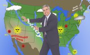
Find a weather map that depicts the weather for the area you wish to include on your map, or collect the relevant weather data. You might find a current weather map in your local or regional newspaper or on a weather website such as Weather.com.
Find the warm and cold air masses depicted by colored lines across the weather map you have found. Draw the symbols for warm or cold fronts onto your map using a line of red semi-circles or blue triangles, respectively. Draw occlusion fronts, where a cold front is overtaking a warm front, as purple lines alternating semi-circles and triangles. Draw stationary fronts in the places where an air mass is not moving as opposing cold and warm fronts meet. The symbol for a stationary front alternates red semi-circles and blue triangles along the line of the front.
Add high and low pressure areas to your map by writing large red Hs and large blue Ls, respectively, in the centers of the pressure zones.
Draw in areas of precipitation with short slash-shaped lines for rain and areas of small asterisks for snow.
Things You'll Need
Resources
About the Author
Sam Packer has been writing professionally since 2003. His publications include articles in local periodicals, student publications, the Boston Globe and a scientific article awaiting submission. Sam holds an Master of Science in Neuroscience and a Bachelor of Arts in Biology both from Brandeis University.