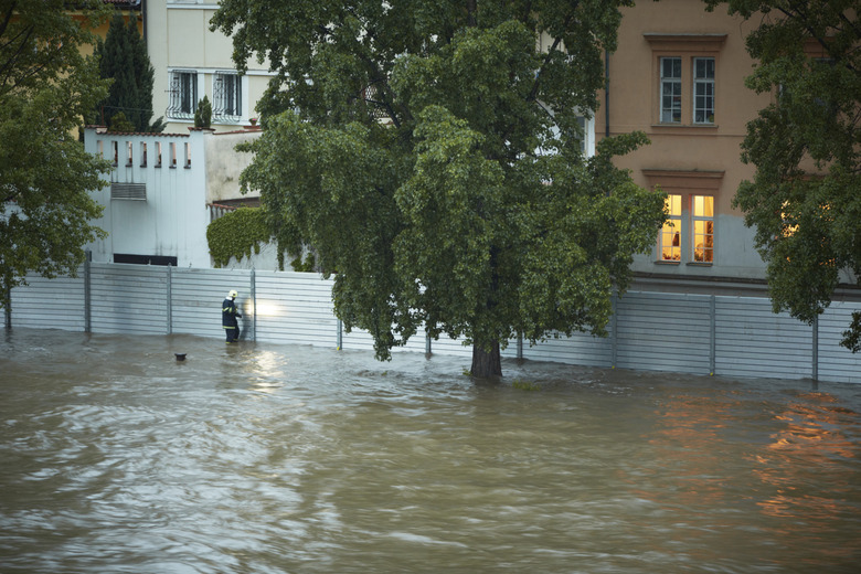
How To Measure The Intensity Of A Flood
According to the U.S. Geological Survey, two critical factors affect flooding due to rainfall: rainfall duration and rainfall intensity — the rate at which it rains. A lot of rainfall over a short period of time can cause significant flooding. However, even more damaging than rainfall-based flooding can be flash flooding caused by non-rainfall factors, such as the flooding of New Orleans in 2005, caused by levee breakage, and the 2004 Indian Ocean tsunami, a deadly wave caused by an earthquake underneath the sea. Sudden melting of ice on mountains can cause rivers to swell and overflow their banks as well. Whether it's major flooding triggered by a slow-moving thunderstorm or flash flooding sparked by a hurricane storm surge, it's possible for expert hydrologists to measure a flood's height, water velocity and other properties that reveal its severity.
Measuring Flood Height
Measuring Flood Height
The USGS has thousands of sites around the country that monitor stream stage, river height and stream flow — the amount of water flowing at a point in time. Gages at those sites measure "gage-height," a term that refers to the height of water in a stream. These gages enable the agency monitor waterways and warn people about dangerous flooding that can occur. After a flood occurs, they also help the flood investigators determine a flood's peak height. When they log flood data, they can better plan development around a waterway and maintain historical records of stream stages that occur over time.
Technology Behind Flood Measurement
Technology Behind Flood Measurement
Several types of equipment exist that gather important hydrological data. They include the float-tape gage — often placed inside a stilling well to measure water levels as they rise and fall. A stilling well protects equipment and also reduces fluctuations in a river, stream or other land feature though which water flows. Pressure transducers measure pressure that a column of water above a measuring device produces. Other devices include the manometer, float sensor gage, staff gage and water-stage recorder. Flood measurements vary from place to place because flooding starts at different levels in different areas.
Alternative Depth Measurement Methods
Alternative Depth Measurement Methods
In locations where no gages have been placed, USGS officials must use other techniques to determine the height a flood reached. One method is to simply be at a location as an observer when a flood occurs. When that's not feasible, investigators can look for clues that help them determine how high flood waters rose at a particular point. For instance, they might check the height of a high-water mark on buildings and trees. Mud covering part of a plant could also indicate how high storm water from a flood rose.
Gleaning Additional Valuable Flood Data
Gleaning Additional Valuable Flood Data
It's possible to determine other important information about a flood using data hydrologists already have. Armed with water height at a specific location, they can use surveying equipment to run a line to a known gage-height measuring station. This enables them to determine the flood's true peak gage-height. Investigators can also use information they acquire to compute a flood's maximum stream flow — the largest amount of water that moves through a location during a fixed time. They may also figure out the flood event's recurrence interval, also called the return period. This interval expresses the probability of another flood occurring that equals or exceeds the flood being analyzed.
Determining Water Velocity
Determining Water Velocity
The rate at which flood waters move is important because water causes more damage the faster it moves. One way to determine a waterway's flow rate is to use a tracer. An investigator pours colored dye into the water and measures the time it takes for the color to move to another location downstream. Radioisotope and chemical tracers can also be used if waters are so turbulent that dye disperses quickly. Current meters help investigators determine water velocity more accurately. When they need to measure flood flows on big rivers, they lower current meters into the water from a bridge or overhead cables attached to a structure above the river.
References
- U.S. Geological Survey: Floods: Questions and Answers (U.S. Geological Survey)
- U.S. Geological Survey: How Stream Height Relates to Stream Flow, USGS Water-Science School
- U.S. Geological Survey: USGS Water Science Glossary of Terms
- U.S. Geological Survey: High-water Marks and Stream Stage, USGS Water-Science School
- Food and Agriculture Organization of the United Nations: Stream Flow
- U.S. Environmental Protection Agency: Stream Flow | Monitoring & Assessment | US EPA
- U.S. Geological Survey: FS-036-98: What is a Recurrence Interval?
- National Oceanic and Atmospheric Administration: Collecting River Stage Data
Cite This Article
MLA
Lee, Kevin. "How To Measure The Intensity Of A Flood" sciencing.com, https://www.sciencing.com/measure-intensity-flood-7967370/. 24 April 2017.
APA
Lee, Kevin. (2017, April 24). How To Measure The Intensity Of A Flood. sciencing.com. Retrieved from https://www.sciencing.com/measure-intensity-flood-7967370/
Chicago
Lee, Kevin. How To Measure The Intensity Of A Flood last modified August 30, 2022. https://www.sciencing.com/measure-intensity-flood-7967370/