What Navigational Tools Were Used In The Year 1400?
The Renaissance ushered in an era of exploration and discovery for Europeans, with new mapping techniques, new economic realities and a hunger to find "new" lands and trade routes. The mariners of 1400 used a combination of old and new technologies to find their way across the sea and back home again.
Finding Their Way
Finding Their Way
Among the oldest and most basic tools was the lead line, used since antiquity to measure depth. This measurement could tell sailors how far they were from land. Another low-tech device, the ka-mal, was developed in Asia and the Middle East. It used a piece of wood marked for the position of Polaris at the latitude of various ports. By 1400, more sophisticated versions used a length of knotted string so the navigator could, by placing the string in his mouth, sight the horizon and the height of Polaris to judge latitude.
Timepieces also aided in navigation. In 1400, mariners still used hourglasses. These, in connection with careful observation of shorelines and accurate logbooks, helped navigators estimate location and predict arrival times.
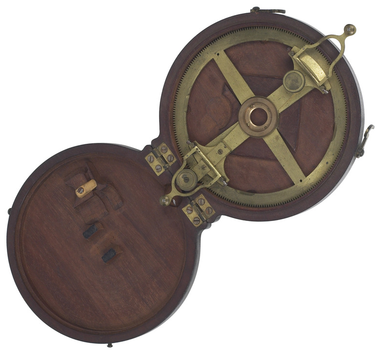
Another device useful for determining latitude by sighting the position of stars was the astrolabe, first developed in ancient Greece but not used for navigation for centuries. An astrolabe has two rotating circles which the navigator sights through and lines up to determine the altitude of the sun or a nighttime star, which helps calculate latitude.
The newest tool was the compass, which uses a magnetized needle to indicate north. Only in the 14th century did compasses become common in navigation. Around that time, the familiar multipointed compass rose or star began appearing on maps to indicate the four cardinal directions.
Cite This Article
MLA
Spirko, Jennifer. "What Navigational Tools Were Used In The Year 1400?" sciencing.com, https://www.sciencing.com/navigational-tools-were-used-year-1400-16808/. 24 April 2017.
APA
Spirko, Jennifer. (2017, April 24). What Navigational Tools Were Used In The Year 1400?. sciencing.com. Retrieved from https://www.sciencing.com/navigational-tools-were-used-year-1400-16808/
Chicago
Spirko, Jennifer. What Navigational Tools Were Used In The Year 1400? last modified March 24, 2022. https://www.sciencing.com/navigational-tools-were-used-year-1400-16808/