What Types Of Land Features Does Delaware Have?
Delaware is the second smallest state in the U.S., with approximately 2, 489 square miles within its narrow borders, according to NetState. Delaware's average elevation is 58 feet above sea level, with only a few areas of high ground; much of the state lies on the Atlantic Coastal Plain, a flat region that covers most of the U.S. eastern seaboard. Despite its small size and flat horizon, Delaware has a range of land features.
Hills
Hills
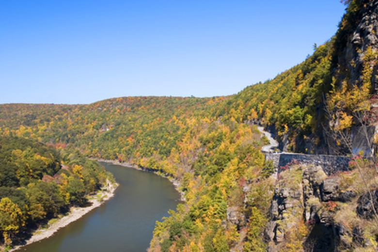
The region known as the Piedmont runs through several states, including Delaware, New Jersey and Alabama. The area is recognizable for its hills, and provides Delaware its highest point at 447 feet above sea level according to worldatlas.com. In Delaware, the Piedmont is in the northernmost part of the state, near the Appalachian Mountains. Some varieties of the rocks found there are estimated to be up to 1.2 billion years old, as noted by the U.S. Geological Survey. Volcanic rocks in the Piedmont include amphibolites, created through the metamorphism of formerly igneous rocks, and the gneiss rocks of the Wilmington Complex area, commonly termed "blue rocks." These rock types formed part of a volcanic island that existed some 500 million years ago.
Wetlands
Wetlands
Southernmost Delaware includes roughly 30,000 acres of swamps. Floodplain hardwood swamps contain trees such as willow oaks and red maple, and are typically found near the tributaries of significant rivers in Delaware. Bald cypress swamps, recognizable by the sheer amount of cypress trees they contain, are a unique ecosystem to this region according to the state's wetlands directory. Coastal plains ponds, also known as Delmarva bays, are small areas that fill with groundwater during the spring and winter months. Delaware has more than 1,000 of these ponds, mostly the middle section of the state; they provide a habitat for many species of flora and fauna, including amphibians such as frogs and salamanders.
Waterways
Waterways
Delaware has approximately 535 square miles of waterways, including rivers, canals and bays. The Delaware River is the state's major tributary; smaller rivers include the St. Jones and Muderkill. Located in the northern part of the state, the manmade Chesapeake and Delaware Canal is a 14-mile waterway used for shipping traffic between Delaware Bay and Chesapeake Bay. The state's Atlantic coast has a 28-mile sandbar, and communities along the sandy shores of Delaware Bay and the ocean coastline offer water sports and fishing to the many tourists who visit annually.
Cite This Article
MLA
Fuller, Simon. "What Types Of Land Features Does Delaware Have?" sciencing.com, https://www.sciencing.com/types-land-features-delaware-7604412/. 24 April 2017.
APA
Fuller, Simon. (2017, April 24). What Types Of Land Features Does Delaware Have?. sciencing.com. Retrieved from https://www.sciencing.com/types-land-features-delaware-7604412/
Chicago
Fuller, Simon. What Types Of Land Features Does Delaware Have? last modified March 24, 2022. https://www.sciencing.com/types-land-features-delaware-7604412/