The Formation Of Tropical Cyclones Explained
Among the seven types of climate and weather-related disasters in the United States, tropical cyclones are the most deadly, accounting for 3,712 deaths from 2013 to 2023 (per the NOAA National Centers for Environmental Information). Hurricanes and typhoons are simply types of cyclones identified based on the region in which they form. No matter the region, though, all cyclones, typhoons, and hurricanes develop in stages.
First of all, tropical cyclones can only form under certain conditions. Tropical or subtropical ocean water that's at least 80 degrees Fahrenheit, with a sufficient distance from the equator, and low vertical wind shear values are the three main weather conditions that form tropical cyclones. The other conditions include an existing atmospheric circulation near the warm water, a quickly cooling atmosphere to form deep convective clouds, and a relatively humid middle atmosphere.
The formation of tropical cyclones begins with the movement of moist air over the ocean surface, fueled by the warm water. As hot air rises and cold air sinks, the evaporated water rises into the atmosphere. Along the way, the water vapor cools and condenses, creating droplets or condensation that are visible as clouds. Then, heat discharges from the condensation into the atmosphere, which makes the air lighter. As that warm air and moisture keep rising, more air from the ocean replaces it with gusto, which creates the wind that you feel from the storm. Meanwhile, Coriolis force causes the spiraling clouds of hurricanes, typhoons, and cyclones. This inertial force redirects the air moving into the center of the storm, allowing the rotation to develop. As the low-level winds spiral inward, high-level winds spiral outward.
The structure of tropical cyclones
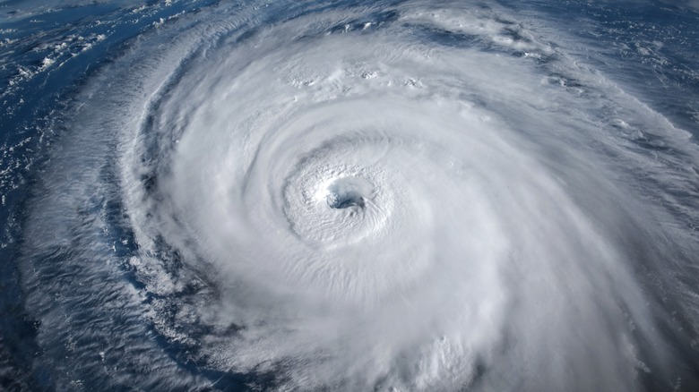
Knowing how tropical cyclones form is only part of understanding these strong storms, as their structure is also important. The most identifiable characteristic is the 20 to 40-mile-wide eye or center, which is generally calm with winds that don't exceed 15 mph and clear skies. Scientists still don't fully understand what causes it, but centrifugal force and the law of conservation of angular momentum are potential explanations.
About 10 to 20 miles from the center of the eye, the eyewall is the most destructive part of tropical cyclones. It's where the deep convective clouds rise from the ocean surface, which is where the rain is heaviest and where most of the rainfall comes from. Also, the horizontal winds are the most powerful in the eyewall, reaching up to 186 mph. It has the strongest vertical wind speeds, too, between 11 and 22 mph.
Extending away from the eyewall are curved rainbands, which consist of thunderstorms that can produce powerful gusts of wind, heavy spurts of rain, and even tornadoes. Between the bands are gaps where there is no rain or wind. If you were to journey from the eye to the outer band of a hurricane or typhoon, you would experience alternating bouts of calm and heavy weather. Combining all of these tropical cyclone parts, these devastating storms can be up to 620 miles in diameter but average between 124 and 310 miles across.

