What Is A River Flood?
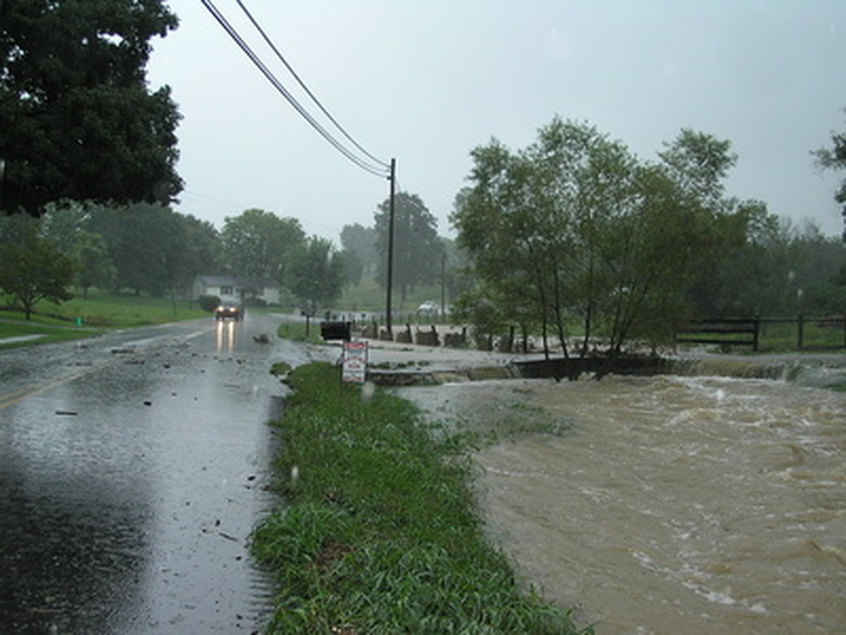
A river flood occurs when a river overspills its banks; that is, when its flow can no longer be contained within its channel. Flooding is a natural and regular reality for many rivers, helping sculpt soil and spread nutrients in alluvial valleys and supporting many ecosystems – such as swamps and bottomland forests – adapted to occasional inundation.
River floods have also been life-giving forces for human societies dependent on them for agriculture and soil fertility. Nonetheless, humans often perceive floods negatively because of the damage and loss of life they often wreak where natural floodways have become heavily developed and populated.
Natural Causes of a River Flood
Natural
Causes of a River Flood
Any pulse of high water that overwhelms a river channel can create a flood, large or small. Common causes include heavy rainfall, including peak seasonal rains in tropical river systems such as the Amazon – the extensive annual flooding of which is a defining feature of this biggest river basin in the world – and more unpredictable torrential downpours caused by tropical cyclones making landfall and other storms.
In mid- and high-latitude rivers as well as lower-latitude rivers draining high, alpine mountains, seasonal snowmelt can also cause flooding due to large volumes of meltwater. Rapid meltoff due to a dramatic spike in temperatures or "rain-on-snow" events are particularly apt to cause rivers to overspill their banks.
Ice jams, where river current backs up behind accumulations of river ice, are another significant cause of flooding on higher-latitude rivers, mainly in the Northern Hemisphere. Major rivers most prone to large ice jams are those that flow north, because, during spring, their upper and middle courses may thaw out and run ice-free while their lower reaches are still icebound. This is the situation, for example, for the Lena River in Siberia, the Mackenzie River of northwestern Canada and the Red River of the U.S. Upper Midwest and Manitoba. Besides backing up waters behind them, ice jams can also produce river floods downstream if they are abruptly breached.
Human Impacts on Flood Rhythms
Human
Impacts on Flood Rhythms
Human-caused (anthropogenic) changes to river basins around the world have profoundly affected the nature of flooding as well as other hydrological characteristics. Constructed levees are meant to confine floodwaters and protect floodplain communities, though they can also result in larger floods by backing up flows above their bottlenecks and by limiting the lateral spread of high-volume discharges, sometimes forcing water levels up enough that levees are overtopped. Failures of both levees and dams can also result in catastrophic flooding.
Riparian (riverside) and floodplain wetlands such as marshes, swamps and bottomland forests historically control flooding by slowing runoff and soaking up overflow. Where humans have removed such wetlands, destructive river floods may become more likely because water levels can rise more rapidly and because the landscape manipulation results in less suitable habitat to sponge up floodwaters.
Of Floods and Floodplains
Of
Floods and Floodplains
Seasonal or otherwise regular flooding of a low-gradient river helps create and maintain one of its valley's defining landforms: the floodplain. The floodplain refers to the relatively flat floor of a river valley surrounding the active river channel itself. It's partly composed of sediments deposited by river overflow during periods of flood.
A meandering river migrates back and forth across its floodplain over time as the outside edges of its sinuous loops actively erode and the inside edges accumulate sediment. As the stream cuts lower, remnants of former floodplains may stand above the newest floodplain as terraces.
Often, meandering rivers become edged by natural levees: low paralleling ridges formed when floodwaters overflow the riverbanks and, slowed by friction as they spill over the floodplain, drop coarser sediments close to the channel. The lower reaches of the floodplain beyond the levees, where overflow tends to pond during floods, are often called backswamps.
10-Year, 50-Year, 100-Year Floods
10-Year,
50-Year, 100-Year Floods
You'll often hear hydrologists, geographers and newscasters speak of 10-year, 50-year, 100-year, 500-year floods and so on. These refer to significant flood events of different magnitudes that impact a specific river system as defined by their recurrence interval, which is an estimate of their average frequency.
While widely used, the terms can be misleading. A 100-year flood isn't a flood that only happens once in a century. Instead, it's a flood whose odds of occurring in any given year are one in 100. A river basin may experience more than one 100-year flood in a hundred years; in fact, it could experience 100-year floods in consecutive years, as long as the relatively rare conditions that produce them – say, extreme rainfall amounts over a short period of time – recur.
Cite This Article
MLA
Shaw, Ethan. "What Is A River Flood?" sciencing.com, https://www.sciencing.com/about-6310709-river-flood-/. 22 November 2019.
APA
Shaw, Ethan. (2019, November 22). What Is A River Flood?. sciencing.com. Retrieved from https://www.sciencing.com/about-6310709-river-flood-/
Chicago
Shaw, Ethan. What Is A River Flood? last modified August 30, 2022. https://www.sciencing.com/about-6310709-river-flood-/