What Is The Average Yearly Rainfall In The Sahara Desert?
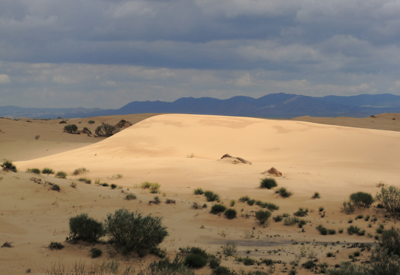
The Sahara Desert is the third largest desert in the world. Antarctica and the Arctic are the two largest deserts, but they are cold deserts, which makes the Sahara the largest hot desert in the world. It is 3.6 million square miles (9.4 million square kilometers), which is about the same size as the United States, including Alaska. The Sahara makes up almost a third of the African continent. The Sahara desert receives zero to three inches of rain per year.
Climate in the Sahara
Climate in the Sahara
Though the Sahara's average annual rainfall is three inches or less per year, there are some areas in the desert that may not see rain for multiple years in a row. Higher elevations also have the possibility of snow. In the summer, temperatures in the daytime are usually over 100 degrees Fahrenheit (38 degrees Celsius). During nighttime in the summer, the temperature can drop to almost freezing.
Archaeologists have discovered that about every 20,000 years the Sahara alternates from a dry, uninhabitable desert to a lush, green oasis. Currently, there are two climatic areas in the Sahara desert. One is a dry subtropical climate in the north, and the other is a dry tropical climate in the south. The subtropical climate in the north has very high annual temperatures and colder winters. The northern region of the desert has two precipitation periods. Most precipitation falls from December through March. August is also a common time for precipitation due to thunderstorms that can even cause flash floods.
The tropical climate in the south has more mild, dry winters, and a hot, dry season before the rains arrive. Much of the rainfall precipitation occurs as thunderstorms, and this region receives five inches per year on average. In the western area of the desert, the cool winds of the Canary Current reduce air temperatures, which also reduces rainfall. This area more commonly experiences humidity and occasional fog.
Geography of the Sahara
Geography of the Sahara
The Sahara is arguably the most famous desert in the world. While you may imagine the endless dunes of sand, the Sahara does have some striking features, such as the Aïr Mountains in central Niger. The highest peak is Mount Bagzane at 6,634 feet (2,022 meters), which was formed from volcanic activity in the area. There is evidence in these mountains that humans have lived here for thousands of years, including Neolithic art. The paintings that have been observed depict a lush savanna with many large mammals, which could be indicative the most recent moist climate.
Biodiversity in the Sahara
Biodiversity in the Sahara
There are very few plants that live and survive in the Sahara Desert. It is estimated that the entire region is home to only 500 species of plants, which is low considering how much area the desert covers. Halophytes are salt-tolerant plants that can be found in salty depressions in the desert. Some heat- and drought-tolerant grasses, shrubs and trees can also survive. There are more fauna species than flora, however. The Sahara desert hosts a surprising 70 species of mammals, 90 resident bird species and 100 species of reptiles. Many animals are able to survive because they get their water exclusively through metabolic processes.
Impacts of Climate Change
Impacts of Climate Change
Recent research has suggested that the Sahara Desert has been expanding in the last century. Researchers found that the desert expanded by 10% between 1920 to 2013. It's possible that natural climate cycles as well as human-caused climate change are responsible for the expansion. The Sahel is a semi-arid transition zone on the southern border of the Sahara. As the Sahara expands, it moves into this fragile grassland ecosystem.
Cite This Article
MLA
Taylor, Lindsey. "What Is The Average Yearly Rainfall In The Sahara Desert?" sciencing.com, https://www.sciencing.com/average-yearly-rainfall-sahara-desert-5097814/. 30 September 2021.
APA
Taylor, Lindsey. (2021, September 30). What Is The Average Yearly Rainfall In The Sahara Desert?. sciencing.com. Retrieved from https://www.sciencing.com/average-yearly-rainfall-sahara-desert-5097814/
Chicago
Taylor, Lindsey. What Is The Average Yearly Rainfall In The Sahara Desert? last modified March 24, 2022. https://www.sciencing.com/average-yearly-rainfall-sahara-desert-5097814/
