What Are The Most Common Landforms?
A landform is a natural physical feature of the Earth's surface largely defined by its form and location in the landscape. Examples of landforms include oceans, rivers, valleys, plateaus, mountains, plains, hills and glaciers. Landforms do not include manufactured features, such as canals, ports and harbors, nor geographic features such as deserts and forests.
The Vast Oceans
The Vast Oceans
Oceans are the most common type of landform in the world. The five oceans – the Pacific, Atlantic, Indian, Southern and Artic – account for more than 70 percent of the Earth's surface. According to the National Oceanic and Atmospheric Administration, this landform contains 97 percent of the Earth's water. There are landforms caused by water and sediment in the ocean, but more than 95 percent of the underwater ocean is unexplored.
Plains are a Dominant Landform
Plains are a Dominant Landform
Plains are the largest land landform in the world. A plain is a broad, nearly level stretch of land with no significant changes in elevation. There are two types of plains: inland plains and coastal plains. Inland plains occur as lowlands at the bottom of valleys but also on plateaus at high elevations. Coastal plains rise from sea level until they adjoin with higher landforms. Plains account for more than 50 percent of the Earth's total land surface.
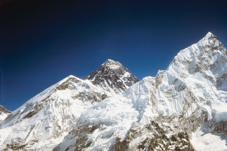
The High Mountains
The High Mountains
Mountains are large landforms that rise well above its surroundings. Typically, these landforms exhibit steep slopes and a relatively narrow summit. Vast uplifts of the Earth's crust – referred to as upward folding – formed most of Earth's mountain ranges. Volcanic accumulations of ash and lava formed others. There is no exact distinction between mountains and hills. However, mountains are typically larger and steeper than hills.
Plateaus and Hills
Plateaus and Hills
A plateau – also a common landform – is a raised area of level land separated from adjoining land by steep slopes. These landforms make up about 45 percent of the Earth's land surface. Plateaus are similar to mountains in that upward folding and volcanic accumulations created the majority of these landforms. Erosion removes great amounts of upland surface and is an additional cause of some plateau formations.
Hills are elevated landforms with distinct summits. These landforms extend above the surrounding terrain but are lower in elevation and less steep than mountains. There are various methods of hill formation such as the buildup of rock debris, deposits of sand by glaciers and wind, faults, erosion and volcanoes. In addition, humans make hills by digging soil and dumping it into a pile.
Cite This Article
MLA
Woods, Drew. "What Are The Most Common Landforms?" sciencing.com, https://www.sciencing.com/common-landforms-8727172/. 20 July 2018.
APA
Woods, Drew. (2018, July 20). What Are The Most Common Landforms?. sciencing.com. Retrieved from https://www.sciencing.com/common-landforms-8727172/
Chicago
Woods, Drew. What Are The Most Common Landforms? last modified March 24, 2022. https://www.sciencing.com/common-landforms-8727172/