What Is The Difference Between Cumulus Clouds & Cirrus Clouds?
A certain Canadian folk singer may lament that she doesn't "know clouds at all," but scientists know clouds very well. They form when moisture in the air condenses into droplets around microscopic dust particles. There are many types of clouds, and they all form by the same process, but they can look very different from the ground. The difference in clouds depends on the altitude at which they form as well as the general atmospheric conditions.
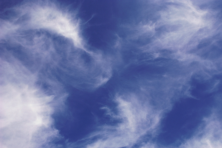
Cirrus clouds are wispy, veil-like clouds that form in the upper troposphere, while cumulus clouds are stacked, dense and fluffy, and they form much closer to the ground. If you're spending an afternoon looking for shapes in the clouds, you're probably watching cumulus clouds. Look through the gaps between the clouds, though, and you may notice a layer of thinner clouds high above them. Those are cirrus clouds.
Cloud Names Usually Give Descriptions
Cloud Names Usually Give Descriptions
The prefix "cirro" comes from Latin and refers to a curl of hair, and cirrus clouds aren't the only type that have this prefix. Cirrostratus clouds are usually large, thin and poorly defined, whereas cirrocumulus clouds are very easy to see from the ground. Cirrostratus clouds can be difficult to see while cirrocumulus are denser and easy to spot; they look like high-flying cotton balls. Cirrus clouds are somewhere in the middle in terms of density and visibility.
The prefix "cumulo," on the other hand, refers to the stacked nature of the clouds to which the prefix applies. Clouds may be altocumulus or cirrocumulus if they form at higher altitudes, while those that form near the ground and remain small are cumulus humilis, or fair-weather cumulus clouds. All have flat bottoms and grow vertically. If a cumulus cloud grows large enough, it can becoming a towering cumulus cloud, and as it grows denser and heavier, it becomes a cumulonimbus cloud, or a storm cloud.
How the Two Types of Clouds Form
How the Two Types of Clouds Form
All clouds form from condensed water, but in the case of cirrus clouds, the water has frozen because the temperature in the region they form in is about -76 degrees Fahrenheit (-60 degrees Celsius). The ice crystals that form the clouds refract sunlight, so you can often see rainbows in the middle of cirrus clouds. The ice crystals ride on the high winds in the upper troposphere, so cirrus clouds often disappear soon after they form, and they never get very dense.
Some of the water droplets that form a cumulus cloud may also be frozen, but most of them are in the liquid state. When the humidity is high, moisture rises on warm air currents and forms layers, and the tops of the cloud reach progressively higher, sometimes into the lower stratosphere. As a large cumulus cloud matures, the water and ice droplets collide, producing an electrical charge that results in thunder and lightning.
Difference in Clouds at High Altitudes
Difference in Clouds at High Altitudes
In areas of high moisture, cumulus clouds can form at the same altitude as cirrus clouds, but the two look very different from the ground. In contrast to the feathery nature of cirrus clouds, stratocumulus clouds are puffy and well-defined. They appear dark on the bottom, because they are too dense for sunlight to penetrate. However, the tops are usually also visible, and they are white, because they are able to reflect sunlight.
Neither of these types of clouds are rain clouds or snow clouds, but if you see them, rain clouds or snow clouds may not be far behind. This is particularly true if they are accompanied by hazy skies. The haze is the early formation of stratus clouds, and these are the ones that usually bring precipitation.
Cite This Article
MLA
Deziel, Chris. "What Is The Difference Between Cumulus Clouds & Cirrus Clouds?" sciencing.com, https://www.sciencing.com/difference-cumulus-clouds-cirrus-clouds-8715452/. 19 September 2018.
APA
Deziel, Chris. (2018, September 19). What Is The Difference Between Cumulus Clouds & Cirrus Clouds?. sciencing.com. Retrieved from https://www.sciencing.com/difference-cumulus-clouds-cirrus-clouds-8715452/
Chicago
Deziel, Chris. What Is The Difference Between Cumulus Clouds & Cirrus Clouds? last modified March 24, 2022. https://www.sciencing.com/difference-cumulus-clouds-cirrus-clouds-8715452/
