How Do Landforms Affect Humans?
Landforms play a critical role in the life of all people. They affect where people choose to live, the foods they can grow, a region's cultural history, societal development, architectural choices and building development. They even influence where military sites work best to defend a region. What lies beneath the ground also plays as important a role in human development as what lies above it.
TL;DR (Too Long; Didn't Read)
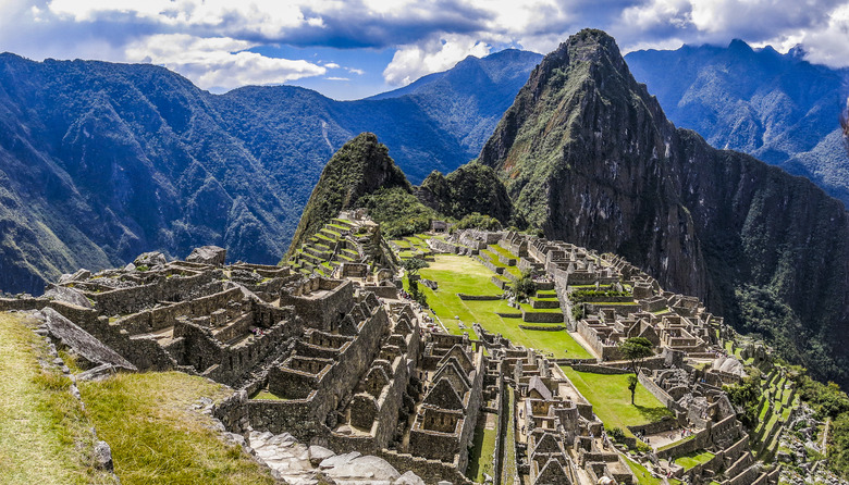
Landforms played an important part in American history. In the Civil War, the battle of Antietam, near Sharpsburg, Maryland, became a crucial turning point for the Union. The area's hilly dolomite and stony terrain gave the advantage to the Union Army in defeating the Confederate Army in this bloody battle. The famous lost city of the Incans, Machu Picchu, owes its existence to the abundance of easy-to-carve granite that the Incans discovered on Huayna Picchu mountain__.__
Landform Characteristics
Landform Characteristics
Landforms represent the topographical features on the surface of the Earth. These features include three major types of landforms: uplands, terraces and floodplains. Upland areas characterize the tallest or highest part of a landform situated above low-lying floodplains. Mountains in the upland regions drain rain and melting snow to river terraces that make it to the floodplains and eventually to the delta areas below. Grouped landforms represent the lay of the land or the landscape of the area. The material beneath the landforms also plays a significant role in the area's development.
Towns and Cities
Towns and Cities
When the pilgrims settled in North America, they often chose low-lying regions suitable for growing crops near clean, fresh water and access to the sea in natural, protected harbors. The land that forms at these locations, and the weather that affects them play an important role in how the early peoples chose locations on which to build their lives and their communities and whether the community thrived.
What Lies Beneath
What Lies Beneath
The manner in which the Sierra Nevada mountains formed in California – from the uplift of the Pacific plate driving beneath the North American plate – brought gold and silver closer to the surface through heated veins in the rock beneath the ground. Erosion from weather exposed these veins on the sides of mountains, and the malleable gold washed down into the waiting rivers below. Placer gold discovered at Sutter's Mill in Coloma, California, became the impetus for the 49er Gold Rush and led to many people moving to California in hopes of cashing in. The gold beneath these landforms eventually played a role in California becoming a state in 1850.
Cite This Article
MLA
Brenner, Laurie. "How Do Landforms Affect Humans?" sciencing.com, https://www.sciencing.com/do-landforms-affect-humans-8611414/. 17 April 2018.
APA
Brenner, Laurie. (2018, April 17). How Do Landforms Affect Humans?. sciencing.com. Retrieved from https://www.sciencing.com/do-landforms-affect-humans-8611414/
Chicago
Brenner, Laurie. How Do Landforms Affect Humans? last modified August 30, 2022. https://www.sciencing.com/do-landforms-affect-humans-8611414/
