What Is The Equator's Latitude?
A standard geographic coordinate system was invented to make navigating around the world easier. Horizontal lines of latitude and vertical lines of longitude make up this grid system, slicing up the Earth in quadrants and angles. By using the center of the Earth as a starting point, an angular distance, measured in degrees, can be calculated and then used to pinpoint the location of a place on Earth's surface.
Latitude Lines and the Equator
Latitude Lines and the Equator
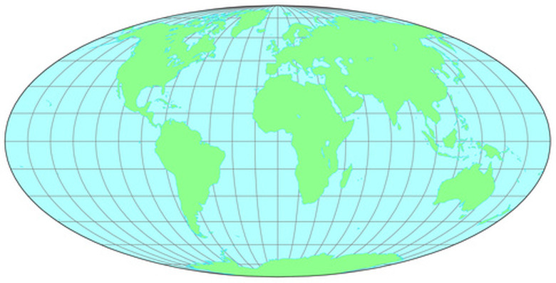
Latitude lines, by definition, mark the angular distance between the equator and either the north or south poles, in reference to the center of the Earth. The equator is used as the origin for the measurement of latitude because it is the line that encircles the Earth's diameter. Because the equator is equidistant from the geographic north and south poles, it divides the northern hemisphere from the southern hemisphere.
How Latitude Is Measured
How Latitude Is Measured
Lines of latitude are parallel to each other. Therefore, any line of latitude above the equator is measured as X degrees north latitude; any below the equator is measured in X degrees south latitude (X is variable, e.g. 10 degrees, 2 degrees, and so on; the abbreviations N for north and S for south are also used).
Latitude of the Equator

Latitude of the Equator
A line drawn from the center of the Earth to the equator would yield an angle of 0 degrees, and therefore, the equator's location is said to be at 0 degrees latitude. Because the equator spans the diameter of the Earth, no N or S is needed to indicate which latitudinal section of Earth is being referenced.
Longitude
Longitude
Whereas lines of latitude run from east to west (horizontally), lines that run north to south (vertically) are known as lines of longitude. By definition, lines of longitude respectively begin and end at the geographic north and south poles—the horizontal spacing between the lines of longitude narrow to 0 degrees at each of the poles, and widen as they approach the equator. In other words, lines of longitude converge at the poles and, therefore, are not parallel to each other. But longitudinal lines perpendicularly intersect lines of latitude. For instance, a line running from the north (or south) pole to the equator yields an angle of 90 degrees, geologist Steven Okulewicz explains.
Geographic Coordinates
Geographic Coordinates
Also known as meridians, lines of longitude range from 0 degrees to 180 degrees from the Prime Meridian (0 degrees) in England to the International Date Line (180 degrees). Geographic coordinates are determined when lines of longitude intersect with lines of latitude. These coordinates determine the location of a place on Earth, such as the equator.
References
- "Physical Geology Laboratory Manual" Steven Okulewicz, Anderson Ohan, Peter Rigotti; 2006
Cite This Article
MLA
Bautista, Nikki Saint. "What Is The Equator's Latitude?" sciencing.com, https://www.sciencing.com/equators-latitude-6314100/. 24 April 2017.
APA
Bautista, Nikki Saint. (2017, April 24). What Is The Equator's Latitude?. sciencing.com. Retrieved from https://www.sciencing.com/equators-latitude-6314100/
Chicago
Bautista, Nikki Saint. What Is The Equator's Latitude? last modified March 24, 2022. https://www.sciencing.com/equators-latitude-6314100/