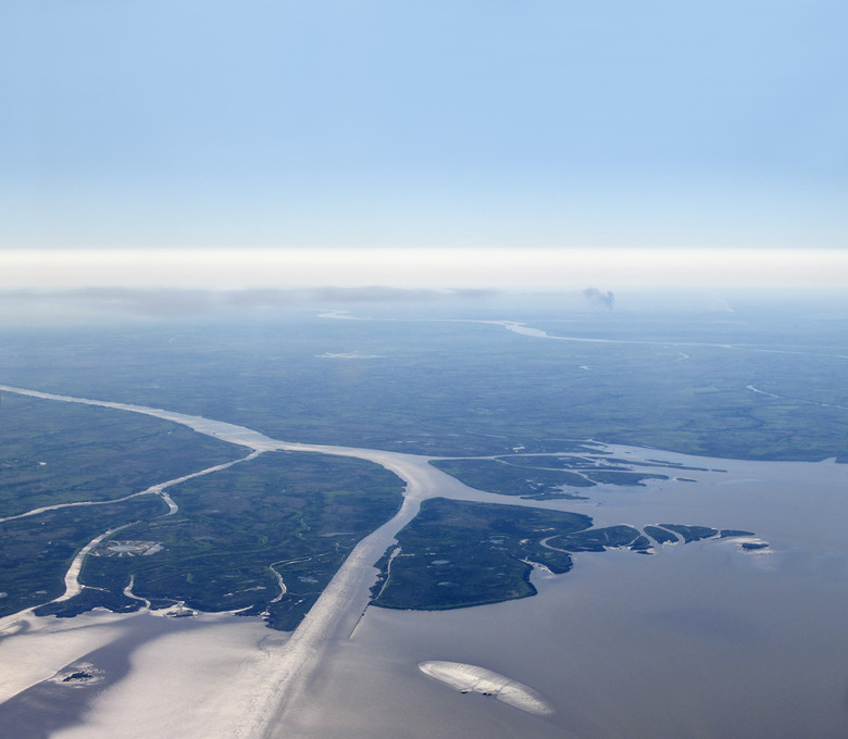
Famous Delta Landforms
Delta landforms occur where rivers dump loads of sediment – silt, sand and small rocks – at their mouths in oceans or large lakes. The Nile delta in the Mediterranean Sea, the Mississippi delta in the Gulf of Mexico, the Yellow River delta in the Bohai Sea and the Ganges-Brahmaputra delta in the Bay of Bengal rank among the most famous. Their brackish, nutrient-rich waters and rich soils have long made deltas such as these important fishing grounds, farmland and settlement sites for human beings.
The Nile
The Nile
The Greek historian Herodotus defined the Nile River's mouth in the Mediterranean as a "delta" based on its triangular, or deltoid, shape – resembling the Greek letter "delta" – thus coining the term now used for rivers all around the world. Civilization has thrived in the Nile delta, which historically provided fertile farmland, since 4000 B.C.; today, some 50 million people live here, though rising sea levels threaten their livelihood by diminishing the delta's area and increasing salinity.
The Mississippi Delta
The Mississippi Delta
The Mississippi delta serves as the best-known example of the "bird's-foot" delta, also called a digitate delta. North America's largest river splits into several channels, or distributaries, at its mouth that lay down sediment in the deep water at the edge of the continental shelf. The scraggly profile of the delta's youngest section suggests the clawed foot of a bird, hence the name. The Mississippi delta began forming about 5,000 years ago and continues to evolve in shape, having advanced the Louisiana coastline here some 15 to 50 miles into the Gulf. In recent decades, however, land subsidence, sea-level rise, human impacts on flow and sediment load and occasional hurricanes have resulted in significant rates of land loss in the Mississippi delta, which includes hundreds of thousands of acres of valuable wetlands.
The Yellow River Delta
The Yellow River Delta
The Yellow River (Huang He) of China carries the heaviest sediment load, making its delta one of the richest in the world. This river carries millions of tons of silt each year. The Yellow River delta has shifted position along the coastline through natural processes for thousands of years, but today agriculture, industry and active human engineering significantly modify the river's course and its delta. These impacts as well as climate effects have greatly reduced the amount of water and sediment carried by the Huang He, which threatens wetlands, aquaculture and human livelihood. It's a bit counterintuitive, but it also increases the probability of flooding because the reduced flow means more sediment deposited on the riverbed, raising the water level.
Ganges-Brahmaputra Delta
Ganges-Brahmaputra Delta
More than 40,000 square miles in area, the delta formed by the many mouths of the Ganges and Brahmaputra rivers at the Bay of Bengal ranks as the largest in the world as well as one of the most fertile and – with better than 100 million inhabitants – one of the most heavily populated. Despite the dense human footprint, the Ganges-Brahmaputra delta still harbors one of the globe's biggest mangrove swamps, the Sundarbans: legendary home of the royal Bengal tiger. Vulnerable to devastating cyclones, the delta also faces many challenges due to climate change, including rising sea levels, diminished river flows due to shrinking Himalayan glaciers and increasing salinity.
Cite This Article
MLA
Blaisdell, Molly. "Famous Delta Landforms" sciencing.com, https://www.sciencing.com/famous-delta-landforms-8258472/. 19 April 2018.
APA
Blaisdell, Molly. (2018, April 19). Famous Delta Landforms. sciencing.com. Retrieved from https://www.sciencing.com/famous-delta-landforms-8258472/
Chicago
Blaisdell, Molly. Famous Delta Landforms last modified August 30, 2022. https://www.sciencing.com/famous-delta-landforms-8258472/
