The Great Rift Valley Represents What Type Of Geological Activity?
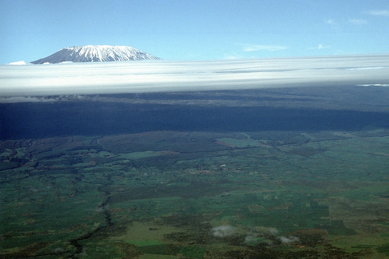
Rifts are places where the crust of the Earth is spreading apart. The Great Rift Valley comprises one such vast expanse, stretching across thousands of miles from Mozambique to the Middle East. Contained within this dramatic rift system are notable sites like Mount Kenya and Mount Kilimanjaro. The Great Rift Valley is the site of major geological activity.
Geography
Geography
In the past, the title "Great Rift Valley" was used as a blanket term for an entire series of rifts stretching from East Africa to the Levant. However, 21st-century geologists generally recognize these rifts as interconnected, albeit not necessarily part of the same overall system. Individual rifts within the grouping include the Jordan Rift Valley, which stretches from Jordan to Israel and encompasses the Dead Sea, the Red Sea Rift, which includes the body of water of the same name, and further south on the African continent, the immense and complex East African Rift. Sometimes, when people refer to the Great Rift Valley, they are referring to the East African Rift. This particularly significant section includes smaller sub-branches, such as the Gregory Rift — which stretches from the Red Sea and Gulf of Aden through Ethiopia, Kenya and into Tanzania — and the Western or Albertine Rift, which arcs from Uganda into Malawi and includes many large lakes.
Past and Future Development
Past and Future Development
Geologists estimate that the collection of rifts commonly known as the Great Rift Valley began forming at least 25 million years ago. During this time, Africa and the Arabian Peninsula were joined together. The Red Sea, which separates them today, did not yet exist. A process known as rifting tore Africa and Arabia apart, so they now lie on separate tectonic plates, and the Indian Ocean flooded into the rift valley to form the Red Sea. This rift continues to develop, with the Red Sea growing increasingly wider. Moving to the south, the African plate continues to split throughout the East African Rift. Here, the Nubian plate, which contains most of Africa, separates from the Somali plate, which carries mainly just the Horn of Africa. Scientists predict that, as this rift continues to develop, waters from the Gulf of Aden may flow in to fill the widening void, in which Horn of Africa would eventually become a large island.
Rifting and Divergent Boundary Formation
Rifting and Divergent Boundary Formation
Most rift valleys are located undersea; the East African Rift is one of the few located on land. Such land-based rift valleys often lie where budding tectonic plates begin to tear away from one another. This separation process is known as rifting and is associated with the formation of divergent plate boundaries. As the Earth's crust breaks apart along a boundary, the ground sinks to create the rift valley. Magma, or molten rock, emerges from underground to fill the void, forming fresh crust. The rifting process may ultimately lead to the birth of entirely new continents.
Volcanism, Earthquakes and Related Phenomena
The magma that seeps upward to fill crustal voids in the rift valley can emerge via volcanoes. Hence, many active and semi-active volcanoes are scattered throughout the region referred to as the Great Rift Valley, including Mount Kenya and Mount Kilimanjaro. However, not all of the rising magma explodes through volcanoes. Some simply wells upward out of fissures, or cracks, in the Earth's surface. Other geological features, such as hot springs and geysers, can be found along some of the rifts associated with the Great Rift Valley. Earthquakes also occur frequently along faults in this region.
Cite This Article
MLA
Harris, Amy. "The Great Rift Valley Represents What Type Of Geological Activity?" sciencing.com, https://www.sciencing.com/great-rift-valley-represents-type-geological-activity-15817/. 24 April 2017.
APA
Harris, Amy. (2017, April 24). The Great Rift Valley Represents What Type Of Geological Activity?. sciencing.com. Retrieved from https://www.sciencing.com/great-rift-valley-represents-type-geological-activity-15817/
Chicago
Harris, Amy. The Great Rift Valley Represents What Type Of Geological Activity? last modified August 30, 2022. https://www.sciencing.com/great-rift-valley-represents-type-geological-activity-15817/