Important Landforms In The U.S.
The term "landform" encompasses all of the geological features on our planet. For example, continents, valleys, canyons, sand dunes and mountains all qualify as landforms. In addition, bodies of water, such as oceans and lakes and water-related landscapes, such as bays and peninsulas, are also landforms. Aside from being part of a continental landform, the United States is covered in geographical features.
Appalachian Mountains
Appalachian Mountains
The Appalachian Mountains may be some of the oldest mountains on earth. The segmented chain of landforms cuts across the eastern side of North America, including U.S. states such as New York, Pennsylvania, Connecticut and Alabama. The highest range is the Blue Ridge Mountains, and the highest peak is at Mount Mitchell.
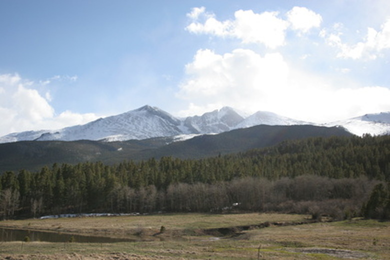
Rocky Mountains
Rocky Mountains
The Rocky Mountains are a mountain range that passes through the western states, such as Utah and Colorado. The Rockies are taller, steeper and craggier than the Appalachians because the western mountains are not old enough to have experienced the same amount of wearing by the elements. Yellowstone National Park and Royal Gorge are examples of the various tourist attractions that are set in the Rocky Mountains.
Great Salt Lake
Great Salt Lake
Utah is home to Great Salt Lake, one of the world's largest terminal lakes. Several nearby rivers empty minerals into the lake, increasing its salinity level. No fish live in Great Salt Lake, but species of shrimp and algae can endure the salty waters.
Grand Canyon
Grand Canyon
At its broadest point, the Grand Canyon is 18 miles wide. The chasm, which is nearly 280 miles long, was formed by the Colorado River. Before becoming a National Park in 1919, the Grand Canyon was a Forest Reserve and National Monument.
Great Plains
Great Plains
Great Plains are predominantly low, flat lands that expand through states such as Nebraska and Kansas. Much of Tornado Alley, an area frequently visited by twisters, falls in the Great Plains.
Mississippi River
Mississippi River
The Mississippi River stretches from Lake Itasca to the Gulf of Mexico, passing through many states, such as Missouri and Kentucky, along the way. The Mississippi National River and Recreation Area encompasses more than 70 miles of the river's corridor.
Mojave Desert & Death Valley
Mojave Desert & Death Valley
The Mojave Desert is the hottest desert in the U.S. The desert spreads across Nevada, Utah, Arizona and California. You can find Death Valley National Park in the Mojave Desert. The lowest point in the valley is nearly 300 feet below sea level, making it the lowest point in the U.S. Temperatures in the desert have reached 134 degrees Fahrenheit.
References
Cite This Article
MLA
Reid, Mitch. "Important Landforms In The U.S." sciencing.com, https://www.sciencing.com/important-landforms-7687175/. 24 April 2017.
APA
Reid, Mitch. (2017, April 24). Important Landforms In The U.S.. sciencing.com. Retrieved from https://www.sciencing.com/important-landforms-7687175/
Chicago
Reid, Mitch. Important Landforms In The U.S. last modified August 30, 2022. https://www.sciencing.com/important-landforms-7687175/