What Kind Of Weather Occurs Along A Stationary Front?
Fronts refer to the boundaries between air masses, which are large, discrete atmospheric bodies of unified weather characteristics. Most familiar are cold and warm fronts, which bring about notable changes in temperature and are often accompanied by the cloudiness and precipitation — and sometimes violent storms — produced as one air mass is forced upward by another. If a cold or warm front halts, it becomes a so-called stationary front.
Stationary Front Basics
Stationary Front Basics
A stationary front is an unmoving one, at least near Earth's surface. Neither abutting air mass has the power to shove through the other. Such a front may form when upper-level winds that had previously propelled a front along shift and flow parallel to it, or where air masses equally matched stall one another's movements. Even though the surficial front may be basically stable, air may be significantly moving about higher up in the atmosphere. A stationary front can eventually dissipate, or, given a shift in upper-level winds or the relative strength of one or another of the air masses, might resume mobility as a cold or warm front.
Typical Weather
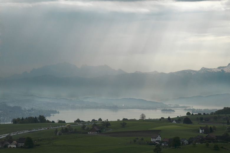
Typical Weather
The exact weather of a stationary front depends greatly on the characteristics of its constituent air masses — their moisture levels, for example — and the general instability of the local atmosphere. Often, however, conditions resemble those encountered along warm front weather: extensive cloudiness and showers. As a stationary front can be durable, such overcast and precipitation may persist for days.
Severe Weather
Severe Weather
Occasionally, stationary fronts may provoke more extreme weather. Series of thunderstorms or heavy rain showers may be shafted down the front, promoting flooding in areas within its influence. A derecho is a fast-moving belt of powerful straight-line winds — the name comes from the Spanish word for "direct" — that are sometimes produced along stationary fronts. Downdrafts from frontal thunderstorms may shunt high winds downward off the jet stream to birth derechos, often bowed outward and fast-advancing. These tempests may be hundreds of kilometers long and howl at 160 kilometers per hour (100 mph) or more. In North America, they mostly develop in spring and summer east of the Rockies. Derechos are important agents of ecological disturbance and potentially lethal hazards to humans, particularly those overtaken in forested areas — the windstorms can flatten entire tracts of timber — or mobile homes.
Symbology
Symbology
On a weather map, different fronts are depicted by symbols of varying color and arrangement. A cold front is illustrated with a line of blue triangles pointed in the direction of travel and thus toward warmer air; warm front weather is shown as a line of red semi-circles pointed toward colder air. A stationary front is shown as a combination of the two: a bead of interlocked red warm-front semicircles and blue cold-front triangles, each oriented toward the respective opposing air mass.
References
- Windows to the Universe: Stationary Fronts
- Meteorology: Understanding the Atmosphere; Steven A. Ackerman, John A. Knox
- National Oceanic and Atmospheric Administration: About Derechos
Cite This Article
MLA
Shaw, Ethan. "What Kind Of Weather Occurs Along A Stationary Front?" sciencing.com, https://www.sciencing.com/kind-weather-occurs-along-stationary-front-22588/. 20 July 2018.
APA
Shaw, Ethan. (2018, July 20). What Kind Of Weather Occurs Along A Stationary Front?. sciencing.com. Retrieved from https://www.sciencing.com/kind-weather-occurs-along-stationary-front-22588/
Chicago
Shaw, Ethan. What Kind Of Weather Occurs Along A Stationary Front? last modified March 24, 2022. https://www.sciencing.com/kind-weather-occurs-along-stationary-front-22588/