What Landforms Are Formed At A Transform Boundary?
Transform boundaries represent the borders found in the fractured pieces of the Earth's crust where one tectonic plate slides past another to create an earthquake fault zone. Linear valleys, small ponds, stream beds split in half, deep trenches, and scarps and ridges often mark the location of a transform boundary. The San Andreas fault, a transform boundary, extends 750 miles from the Californian-Mexican border through San Francisco where it runs along the coastline before doglegging out to sea near Eureka, California.
Tectonic Plates
Tectonic Plates
The Earth's crust is fractured into giant pieces, called tectonic plates. These plates move atop the Earth's mantle, a fluid layer of molten rock. When one plate moves horizontally beside the other, a transform boundary is formed. The Earth's crust contains seven main plates: North American, Pacific, South American, Eurasian, Australian, Antarctic and African. Minor plates also exist, some of which are the Nazca, Philippines and Arabian plates.
TL;DR (Too Long; Didn't Read)
In geology, three types of boundaries exist: divergent, convergent and transform. Divergent boundaries occur where two plates spread apart, typically creating new oceanic crust. Convergent boundaries happen where two plates collide together, as seen in the Washington-Oregon coastline of the United States, where the Pacific Plate gets forced beneath the North American plate, creating a subduction zone that destroys oceanic crust. Transform boundaries, also known as conservative boundaries, ensue where two plates slide horizontally past each other.
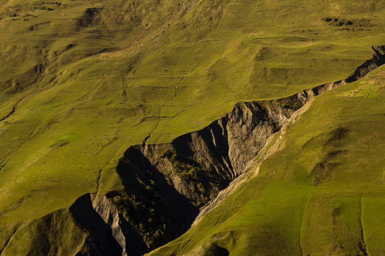
Fault Lines
Fault
Lines
One of the primary landforms that is produced by a transform boundary is a fault. Typically known as strike-slip faults, they build up pressure when friction prevents them from sliding until the pressure exceeds the force of the friction and results in an earthquake.
The most well-known of transform boundaries — the San Andreas fault — connects the East Pacific Rise, a divergent zone to the south, with the South Gorda, Juan de Fuca plate, a smaller, older plate consisting of all three boundary types and Explorer Ridge, to the north. Viewed from the air, the fault line is represented by a linear, shallow trough. From the ground, the fault line can be identified by several characteristic landforms, including long straight escarpments, narrow ridges and small ponds formed by settling.
Oceanic Fracture Zones
Oceanic
Fracture Zones
Most transform boundaries lie on the seafloor. These oceanic fracture zones form large valleys, or trenches that connect spreading oceanic ridges. These features can extend anywhere from 100 miles to more than 1,000 miles, reaching depths of up to five miles. The Clarion, Molokai and Pioneer fracture zones, located off the west coast of California and Mexico, are prime examples. While these zones are currently inactive, their scars provide a graphic reminder of the power transform boundaries pose to alter the Earth's landscape.
Complex Transform Boundary Features
Complex
Transform Boundary Features
The Dead Sea Rift represents the combination of a rift with a transform boundary. The rift itself, a continuation of the African Rift, forms the valley through which the Jordan River flows. However, this rift is also the location of a transform boundary, where the Arabian Plate is sliding past the Sinai-Israeli Plate.
In this case, both plates are moving northward, but at different rates. This has created a strike-slip fault similar to the San Andreas Fault. This fault produced a major earthquake at its southern end in A.D. 363 that leveled the city of Petra. In 1202, an estimated 7.6 magnitude earthquake struck at the northern end, with an estimated 1 million fatalities. At the time of writing, the fault is missing an estimated 14 feet of slip, meaning another major earthquake is imminent.
Cite This Article
MLA
Bennett, Doug. "What Landforms Are Formed At A Transform Boundary?" sciencing.com, https://www.sciencing.com/landforms-formed-transform-boundary-8592956/. 23 April 2018.
APA
Bennett, Doug. (2018, April 23). What Landforms Are Formed At A Transform Boundary?. sciencing.com. Retrieved from https://www.sciencing.com/landforms-formed-transform-boundary-8592956/
Chicago
Bennett, Doug. What Landforms Are Formed At A Transform Boundary? last modified August 30, 2022. https://www.sciencing.com/landforms-formed-transform-boundary-8592956/