Nile Delta Facts
The planet's longest river, the Nile, has a mouth that forms a famous triangle called the Nile Delta. Deltas form when silt and sediments accumulate at the mouths of large rivers. Most of Egypt's habitable land is within the Nile Delta and along the Nile River. With a rich and diverse cultural history, the Nile Delta is one of northern Africa's most fertile regions — people have farmed it for thousands of years.
Nile Delta Quick Facts
Nile Delta Quick Facts
The word delta gets its name from the fact that the Greek letter delta looks like the triangular area at the mouth of the Nile. Deltas become complex over time as sediments build up in different areas. A river may even alter its course when sand barriers, channels and marshes form in its delta. With an area of around 22,000 square kilometers (8,494 square miles), the Nile Delta is Egypt's main oil and gas producing region.
Climate and Environment
Climate and Environment
Part of the great desert belt, the Nile Delta region is warm, with Cairo experiencing average January temperatures of 12 degrees Celsius (53.6 Fahrenheit) and average July temperatures of 31 degrees Celsius (87.8 Fahrenheit). It doesn't rain much in the region, but when it does, rainfall occurs in the winter. Most of the Nile Delta's hazardous waste comes from chemical plants. Sewage, agricultural pesticides and industrial activities also cause water pollution in branches of the Nile and its lakes.
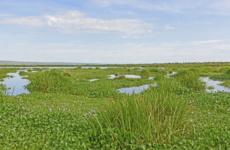
Wildlife in the Delta
Wildlife in the Delta
Saltwater and freshwater species make up the Nile Delta's aquatic fauna. The delta's limited mammal fauna includes the red fox and Egyptian mongoose. The hippopotamus became extinct in the region during the last 200 years. You'll also find one of the planet's most important bird migration routes in the Nile Delta. Millions of birds traveling between Africa and Europe pass through the delta region.
Nile Delta Water Problems
Nile Delta Water Problems
The High Aswan Dam, completed in 1970, brought important benefits to the Nile Delta. In addition to providing flood control, it helps reduce drought and generate hydroelectric power. Unfortunately, the dam restricts the spread of fertile sediments that occur annually through floods. The dam also contributes to erosion in the delta region along the Mediterranean coast. Scientists have suggested that higher sea levels and extreme weather could impact the Nile's delta negatively as global temperatures climb. Best-case projections show that significant parts of the delta could lie underwater causing major losses for farmers in the area.
References
- National Oceanic and Atmospheric Administration: Deltas
- University of Michigan: Human Impacts on the Nile River: Natural Impacts
- Sustainable Agriculture Reviews; Eric Lichtfouse
- The Nile: Origin, Environments, Limnology and Human Use; Edited by Henri J. Dumont
- Google: Freshwater Ecoregions of Africa and Madagascar: A Conservation Assessment; Michele L. Thieme, Robin Abell, Neil Burgess, Bernhard Lehner, Eric Dinerstein, David Olson
- World Wildlife Federation: Nile Delta Flooded Savanna | Ecoregions
- Coastal Zone Management Imperative for Maritime Developing Nations; Edited by B.U. Haq
Cite This Article
MLA
Lee, Kevin. "Nile Delta Facts" sciencing.com, https://www.sciencing.com/nile-delta-7289614/. 24 April 2017.
APA
Lee, Kevin. (2017, April 24). Nile Delta Facts. sciencing.com. Retrieved from https://www.sciencing.com/nile-delta-7289614/
Chicago
Lee, Kevin. Nile Delta Facts last modified March 24, 2022. https://www.sciencing.com/nile-delta-7289614/