Texas Geography & Soil Types
Texas geography varies from subtropical grasslands and wetlands on the Gulf Coast Plain to arid deserts at the southern extent of the Basin and Range province of the Rocky Mountains, and then north to the fertile grasslands of the high plains. Soils throughout the state are generally developed over limestone sediments, with some shallow soils over igneous rock in the west.
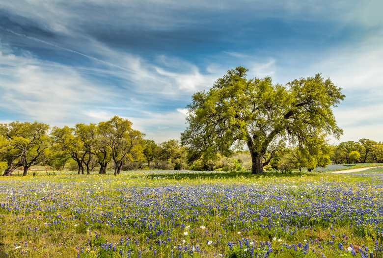
Texas Is Big
Texas Is Big
At 261,797 square miles of land, Texas stretches from Brownsville on the southern tip of the Gulf Coast to the Rita Blanca National Grassland 801 miles north on the Oklahoma border. From the arid western desert around El Paso, Texas stretches 773 miles east to its Louisiana border.
Galveston Bay to Piney Woods
Galveston Bay to Piney Woods
East Texas is in the Gulf Coastal Plain at the southern end of the North American Prairie. From Sabine Pass to Galveston Bay, the Gulf Coast receives 50 inches of rain annually that supports tall grassland and marshland on neutral to acidic, poorly drained clay and loam soils. Moving inland directly north, the "Piney Woods" receive 42 inches annually that support long leaf pine and bluestem grasses on fine sandy to sandy loam or sandy clay soils.
Matagorda Bay and Northward
Matagorda Bay and Northward
Moving south along the Gulf Coast, rainfall decreases. Matagorda Bay receives 34 inches, as do areas inland and due north, including blackland prairies and post oak savannah near Oklahoma. East Texas is underlain by limestone, so soils are rich in calcium. Blackland prairies are grasslands isolated among hardwood and pine forests. Texas blackland is associated with post oak savannah, where grasses on sandy soil in uplands share the prairie with hardwoods on clay soils in bottomlands. The area has an impervious clay pan in the subsoil.
South Texas Plains and Cross Timbers
South Texas Plains and Cross Timbers
At the southern tip of Texas, Brownsville receives 26 inches of annual rainfall. Areas northward with similar rainfall include the south Texas plains and the cross timbers and prairie region on the Oklahoma border. The south Texas plains are dry grassland with thorny shrubs growing on acidic sandy soils. The cross timbers region has neutral to alkaline soils that support hardwoods such as post oak, associated with grassland on acidic soils.
Edwards Plateau and the High and Rolling Plains
Edwards Plateau and the High and Rolling Plains
The Balcones Escarpment of central Texas uplifts Edwards Plateau, ranging from 300 feet above the coastal plain at Austin to 1,000 feet at Del Rio. Rainfall varies from 35 inches in the east to 23 in the west. Soils are shallow yellowish clay to clay loam. In the Panhandle, the rolling plains at 900 to 4,000 feet elevation have fertile soils developed under grassland. The western half of the Panhandle is high plains short grassland with alkaline, heavy clay soils underlain by caliche.
Trans-Pecos or Mountain Forest
Trans-Pecos or Mountain Forest
The Trans-Pecos between the Pecos River and El Paso is as large as the state of South Carolina. Rainfall varies from 12 to 20 inches. Shallow alkaline soils developed over igneous rocks or limestone in the mountains, but canyons and valleys have deeper soils. Chihuahuan Desert shrubs such as cacti, yucca, agave and creosote give way to conifers at higher elevations. Rainfall occurs July to September, drains inward and evaporates in temperatures above 100 F.
References
- Texas Almanac: Environment
- "Texas Quails: Ecology and Management"; Leonard Alfred Brennan; 2007
- "Blackland Prairies of the Gulf Coastal Plain"; Evan Peacock and Timothy Schauwecker; 2003
- Texas Parks and Wildlife: Post Oak Savanna and Blackland Prairie Wildlife Management
- Texas Forest Service: Texas Eco-Regions, South Texas Plains
Cite This Article
MLA
Kirchheimer, Sara. "Texas Geography & Soil Types" sciencing.com, https://www.sciencing.com/texas-geography-soil-types-8507579/. 22 November 2019.
APA
Kirchheimer, Sara. (2019, November 22). Texas Geography & Soil Types. sciencing.com. Retrieved from https://www.sciencing.com/texas-geography-soil-types-8507579/
Chicago
Kirchheimer, Sara. Texas Geography & Soil Types last modified August 30, 2022. https://www.sciencing.com/texas-geography-soil-types-8507579/