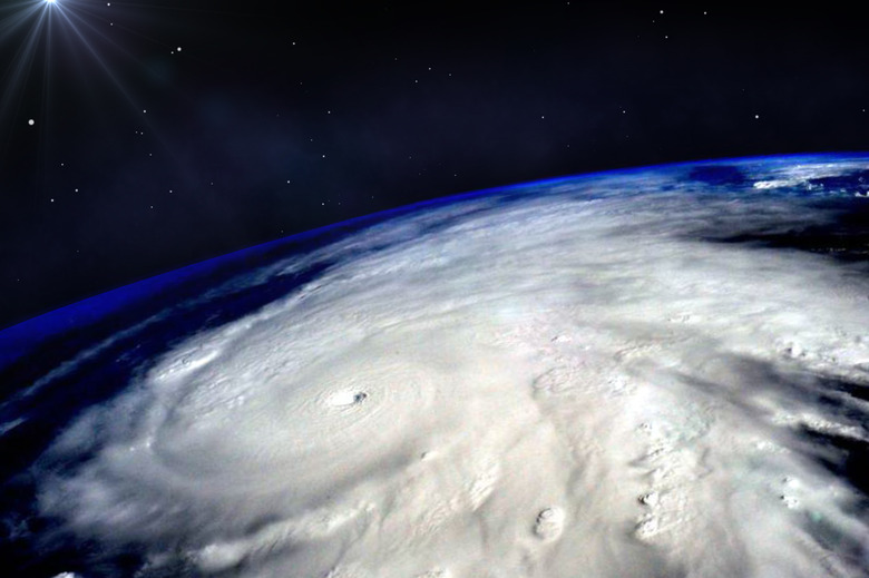
The Seismic Whack Of Tropical Cyclones
Brewed up over warm remote brine but often steered toward populated shores, tropical cyclones account for some of the most violent storms native to Planet Earth. In the face of warming temperatures associated with climate change, one burning question is whether these destructive disturbances – which, despite the damage to human life and property they wreak, play a vital role in distributing heat energy – are growing stronger and more frequent. Because tropical-cyclone activity varies so much from year to year, and because satellite records only go back to the late 1960s and early '70s, it's hard for scientists to assess the trends. A new study, however, suggests that decades of data collected by the seismometers used to monitor earthquakes may offer a more extensive historical record of storms to analyze.
TL;DR (Too Long; Didn't Read)
A new study suggests scientists may be able to gauge the intensity of tropical cyclones from their seismic footprint. Because seismic readings go back decades further than satellite data, this means we might be able to track long-term trends in storm strength – perhaps helping discern the impact of climate change.
Ambient Seismic Noise and Tropical Cyclones
Ambient Seismic Noise and
Tropical Cyclones
Seismometers measure the wiggles and lurches of the planet induced by earthquakes and volcanic eruptions – and of a whole host of other forces, from industrial activity to (especially) colliding ocean waves. Because the primary focus is usually temblors spiking seismic readings against a background of those other, lower-level vibrations, they're referred to as ambient seismic noise.
It's been common knowledge that the movement of tropical cyclones, also called (depending on the ocean basin) typhoons and hurricanes, leave a seismic signature as part of that ambient noise: Ocean waves roiled by the storm's passage smash against coastlines, but more significant are the vertical pressure aberrations they generate when crashing together, which cause vibrations in the seafloor.
Previously scientists have mainly used that knowledge to track a particular tropical cyclone. Lucia Gualtieri, of Princeton University's Department of Geosciences, wondered whether the seismic record could be sifted through to identify the signatures of past storms.
The Study
The Study
Gualtieri and a diverse team of fellow geoscientists, atmospheric scientists and a statistician tackled the question by examining 13 years' worth of seismic and satellite records in the Northwest Pacific, the most active and intense tropical-cyclone basin and one well monitored by seismometers. (Tropical cyclones in this region are called typhoons.) The researchers connected atmospheric data on typhoons of Category 1 strength or higher, disregarding Category 1 storms that lasted less than two days, from 2000 to 2010 with seismometer readings to develop a model for gauging a storm's intensity from its seismic footprint. They then applied the model to seismic readings from 2011 and 2012 and compared it with typhoon data from the satellite record to evaluate how accurate it was.
As it turns out, the model proved quite good at estimating typhoon intensity from a seismogram (the chart produced by a seismometer). And the research suggests the relationship between the strength of the seismic signal and the strength of the storm that generated it is roughly linear. "This linear relationship has significance because it allows us to more easily see changes [over time]," Gualtieri told Cody Sullivan for the National Oceanic and Atmospheric Administration's Climate.gov news site. "When you have a one to one relationship, the computations of strength are easier and so are the comparisons between cyclones."
The team's findings were published in February 2018 in Earth and Planetary Science Letters.
Ghost Typhoons: Peering Back in Time to Gauge Storm Trends
Ghost Typhoons: Peering Back
in Time to Gauge Storm Trends
Gualtieri and her colleagues want to hone their model and test it in the globe's other tropical-cyclone basins, such as the Caribbean. If they find similar success parsing out the signature of tropical cyclones from ambient seismic noise and estimating from it storm intensity, scientists may have a valuable tool for documenting the frequency and ferocity of tropical cyclones that raged and howled before satellites were measuring them.
Seismograms date back to the 1880s, although the earliest are on paper and many such records still need to be digitized. "If all this data can be made available, we could have records going back more than a century, and then we could try to see any trend or change in intensity of tropical cyclones over a century or more," Salvatore Pascale, one of Gualtieri's coauthors and a Princeton University associate research scholar in atmospheric and oceanic sciences, said in a Princeton press release.
The exciting possibility, in other words, is that we now may have a means of evaluating many decades of tropical cyclones prior to the satellite era – and thus the ability to study a more extensive dataset to help determine whether the warming of the planet is resulting in fiercer typhoons and hurricanes.
Cite This Article
MLA
Shaw, Ethan. "The Seismic Whack Of Tropical Cyclones" sciencing.com, https://www.sciencing.com/the-seismic-whack-of-tropical-cyclones-13710357/. 29 March 2018.
APA
Shaw, Ethan. (2018, March 29). The Seismic Whack Of Tropical Cyclones. sciencing.com. Retrieved from https://www.sciencing.com/the-seismic-whack-of-tropical-cyclones-13710357/
Chicago
Shaw, Ethan. The Seismic Whack Of Tropical Cyclones last modified March 24, 2022. https://www.sciencing.com/the-seismic-whack-of-tropical-cyclones-13710357/
