Types Of Cyclones
A cyclone describes a weather system characterized by swirling winds around a low-pressure center; wind direction around the low is counterclockwise in the Northern Hemisphere, clockwise in the Southern Hemisphere. Coming in a wide variety of sizes and settings, cyclones cause some of the most dramatic and outright violent weather on the planet, including the tropical cyclones known as hurricanes and typhoons. The science behind cyclones will help you understand why, where and how this weather phenomena exists.
Tropical Cyclone
Tropical Cyclone
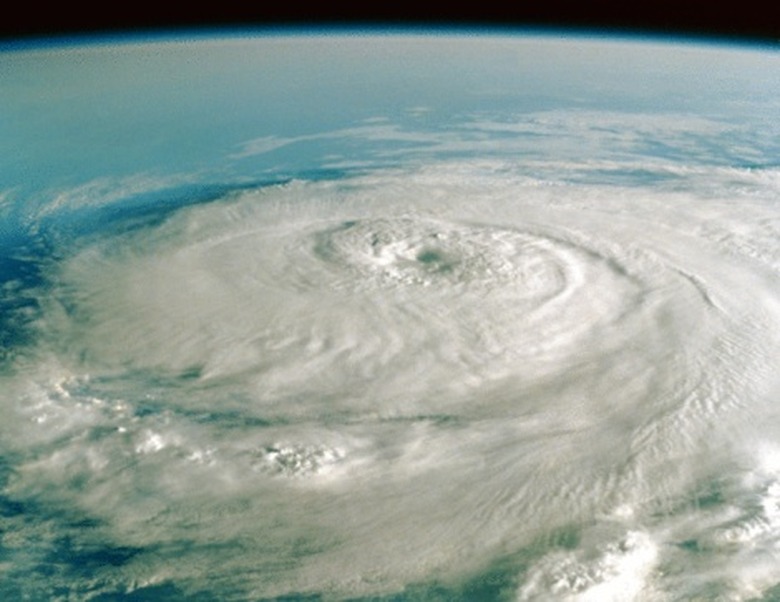
The National Weather Service defines a tropical cyclone as "a rotating system of clouds and thunderstorms that originated over tropical or sub-tropical areas." The major tropical-cyclone basins include the North Atlantic (including the Caribbean), Eastern Pacific, Western Pacific, North Indian Ocean, Southwest Indian Ocean, Southern Pacific and Australian region. Typically tropical cyclones develop within 5 and 30 degrees of latitude, as they require ocean waters of 80 degrees Fahrenheit or so to form. Winds funnels into a low-pressure disturbance, evaporating warm surface waters and releasing energy as rising air condenses into clouds.
Hurricanes, Cyclone, Typhoons and Tornadoes
Hurricanes, Cyclone, Typhoons and Tornadoes
The terminology associated with tropical cyclones can be confusing, because people call these dangerous storms by different names in different parts of the world. In the North Atlantic and Caribbean as well as the northeastern Pacific, they go by "hurricane." In the Northwest Pacific – the most active tropical-cyclone basin in the world – they're "typhoons," while in the Indian Ocean and South Pacific they're simply "tropical cyclones" or "cyclones." Tornadoes – much smaller and more localized than tropical cyclones, and capable of generating even higher wind speeds – are occasionally colloquially called "cyclones," though they're completely different storms.
Mesocyclones: Tornado Factories
Mesocyclones: Tornado Factories
Especially strong thunderstorms called supercell thunderstorms – which generate by far most of the world's strongest tornadoes – exhibit spinning updrafts called mesocyclones. Rotating "wall clouds" may descend from mesocyclones and ultimately form a funnel cloud, which, if it contacts the ground, becomes a tornado. The United States experiences approximately 1,700 mesocyclones a year, with roughly 50 percent of these turning into tornadoes.
Midlatitude or Extratropical Cyclones
Midlatitude or Extratropical Cyclones
Hurricanes and typhoons may be better known to laypeople, but the cyclonic storms that develop along frontal boundaries in the middle latitudes – called "extratropical cyclones" or "midlatitude cyclones" – are just as significant. These cyclones – which, unlike their tropical counterparts, develop where sharp temperature gradients exist between adjoining air masses – can be much larger then hurricanes, although their winds are generally weaker. A prominent example of the midlatitude cyclone is the "nor'easter" that often impacts the U.S. East Coast, particularly in winter.
Polar Lows, aka "Arctic Hurricanes"
Polar Lows, aka "Arctic Hurricanes"
Hurricane-like cyclones called "polar lows" occasionally form over Arctic and Antarctic seas, sparked by frigid air moving over somewhat warmer ocean waters. In the Northern Hemisphere, meteorologists sometimes call polar lows "Arctic hurricanes" because both their energy source – heat transfer from water to air and latent heat released by cloud condensation – as well as their spiraled cloud bands are somewhat similar to a tropical cyclone's. Polar lows often form quickly, sometimes in less than 24 hours, and can be difficult to forecast.
Cite This Article
MLA
Jones, Verity. "Types Of Cyclones" sciencing.com, https://www.sciencing.com/types-cyclones-8572905/. 10 April 2018.
APA
Jones, Verity. (2018, April 10). Types Of Cyclones. sciencing.com. Retrieved from https://www.sciencing.com/types-cyclones-8572905/
Chicago
Jones, Verity. Types Of Cyclones last modified March 24, 2022. https://www.sciencing.com/types-cyclones-8572905/
