What Is The Importance Of Topographic Maps?
Topographic maps are an important tool because they can represent the three-dimensional landscape in two dimensions. A person who can read a topo map can find out the location of peaks, valleys, ridges and saddles, among other land features. Topo maps can also show you whether you will be traveling uphill or downhill on a particular road or trail.
Contour Lines
Contour Lines
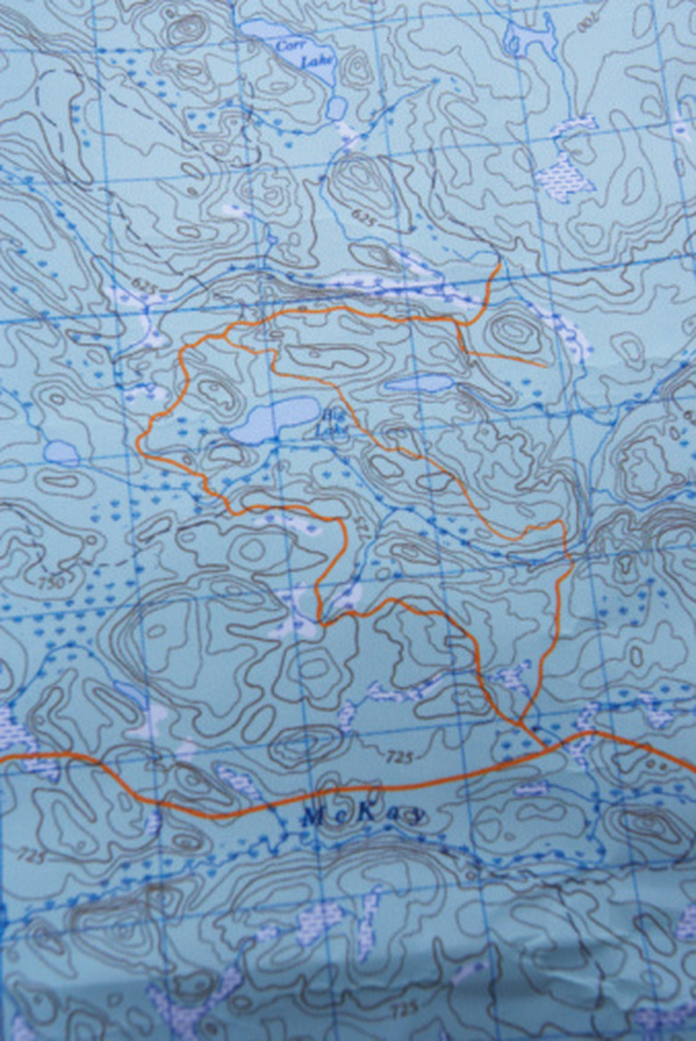
Elevations on a topo map are marked with contour lines, which connect points of equal elevation. Imagine walking around a mountain in a circle, never going uphill and never going downhill but staying at the same altitude. If you traced the path you walked, you would have a contour line on a map. Contour lines are typically separated by 40 vertical feet, though you should check the map you're using to be sure, and every fifth contour line is usually marked with an actual elevation.
Land Features
Land Features
The shape of the contour lines can tell you the shape of the landforms in a particular area. For example, concentric circles show a peak, with the smallest circle marking the summit. Contour lines that are close together indicate that the land is very steep, while contour lines that are spread apart show that the land is relatively flat. Contour lines that encircle two peaks — or two sets of concentric circles — can indicate the presence of a saddle, or gap, between the peaks.
USGS Maps
USGS Maps
Topographic maps of the entire country have been produced by the U.S. Geological Survey, which began surveying land to create such maps in 1879. Today, the USGS has created more than 54,000 maps, which form the basis of most commercially available topographic maps used today. USGS topo maps also show features that you would see on regular road maps, including highways, dirt roads, towns and structures. The maps also show power lines, rivers, glaciers and mines.
Orienting the Map
Orienting the Map
To match a topographic map to the landscape around you, which will allow you to identify features such as mountains and rivers, it's important to make sure the map is oriented correctly. You can quickly orient the map by using a compass and the "compass rose" found on the map, which will have an arrow pointing north. Line up the compass needle, which points north, with the arrow on the compass rose, turning the map if necessary.
Cite This Article
MLA
Steinbauer, Catherine. "What Is The Importance Of Topographic Maps?" sciencing.com, https://www.sciencing.com/what-is-the-importance-of-topographic-maps-12536541/. 18 October 2017.
APA
Steinbauer, Catherine. (2017, October 18). What Is The Importance Of Topographic Maps?. sciencing.com. Retrieved from https://www.sciencing.com/what-is-the-importance-of-topographic-maps-12536541/
Chicago
Steinbauer, Catherine. What Is The Importance Of Topographic Maps? last modified March 24, 2022. https://www.sciencing.com/what-is-the-importance-of-topographic-maps-12536541/